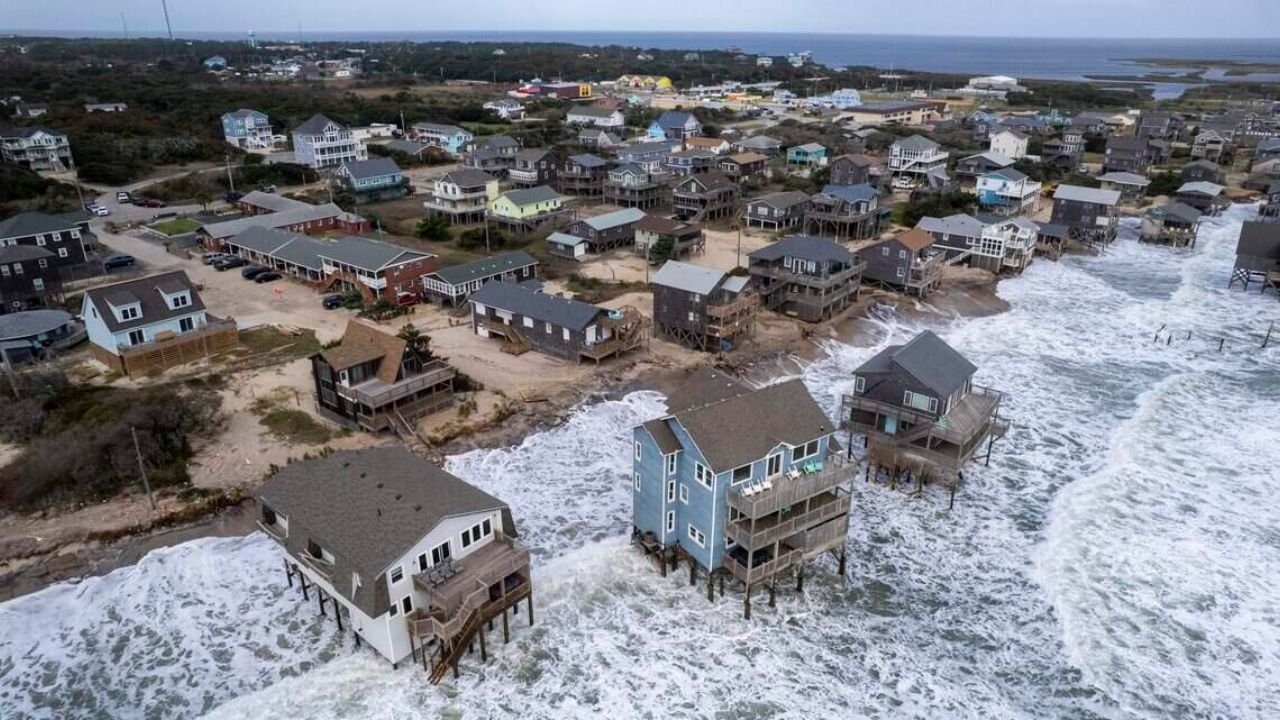
A nor’easter could bring powerful wind gusts, large waves and coastal flooding to North Carolina’s Outer Banks this weekend, with forecasters warning that some areas could also experience beach erosion.
The National Weather Service expects a coastal storm to develop along a cold front moving through the region early Saturday. However, meteorologists say uncertainty remains over exactly where the storm will form, how strong it will become and how long it will linger along the coast.
According to a National Weather Service briefing on Friday, Oct. 16, waves could reach 6 to 12 feet or higher, while wind gusts could peak around 50 mph.
Ryan Ellis, a meteorologist with the National Weather Service’s Morehead City office, said forecast models suggest the developing low-pressure system could remain near the coast for several days before eventually moving offshore.
The main uncertainty is how long the system will linger, Ellis explained.
Coastal Flooding and Beach Erosion Possible
Forecasters are gaining confidence that strong winds and high waves will affect portions of the North Carolina coast. The conditions could cause minor to moderate coastal flooding, along with beach erosion as powerful waves push water and sand onto shore.
Areas of the Outer Banks that suffered significant damage during a nor’easter in late September could face greater risks from the approaching storm.
That earlier storm washed out portions of North Carolina Highway 12, a critical route connecting communities along the Outer Banks. It also produced waves reaching 18 feet and prompted warnings about life-threatening beach hazards.
Highway 12 reopened on Oct. 8 after North Carolina Department of Transportation crews rebuilt protective sand dunes.
Ellis noted that locations already vulnerable from the previous storm could experience some of the most significant impacts if the new system brings prolonged strong winds and large waves.
Gale Advisory Warns Boaters of Hazardous Conditions
A Gale Advisory has been issued, alerting boaters and mariners to potentially dangerous marine conditions. Those heading onto the water should take the warning seriously and seek safe harbor as advised by local authorities.
The developing nor’easter also serves as a reminder that coastal storms can continue to affect North Carolina well beyond the summer hurricane season.
Ellis said similar systems can develop along or move up the East Coast throughout the winter. Some can produce extremely strong winds comparable to those associated with hurricanes, even though they are not tropical systems.
El Niño Could Contribute to an Active Winter
The approaching storm comes as forecasters look ahead to the winter season and monitor the potential influence of El Niño.
El Niño can affect weather patterns across the United States, including precipitation and storm activity in parts of North Carolina. Its influence varies depending on the strength of the climate pattern and other atmospheric conditions.
Ellis said the pattern could contribute to a more active period of coastal low-pressure systems during the winter months.
Although the Atlantic hurricane season continues through the end of November, meteorologists will increasingly focus on winter storms as the season progresses.
For residents and visitors along the Outer Banks, the immediate concern remains the approaching nor’easter, particularly its potential to bring strong winds, hazardous surf, coastal flooding and additional erosion to areas still recovering from September’s storm.
Because the storm’s exact track and duration remain uncertain, residents should monitor National Weather Service updates and local advisories throughout the weekend.